Oxley Creek Recreational Water Quality Monitoring
Brisbane Sustainability Agency has commenced a monthly water quality monitoring program, including sampling and analysis, to improve our understanding of, and track the changes in, the water quality of Oxley Creek.
The water quality monitoring program results provide an indication of the potential risks to human health associated with the presence of varying levels of microbial contamination within the creek water. The presence of microbial contamination is common in urban waterways, and levels can vary on a daily basis. These changes in level may affect recreational use of the creek as contact with the water could pose a health risk.
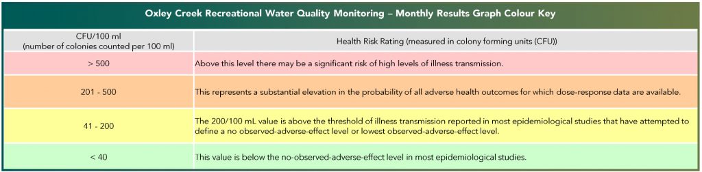
The creek water is tested for levels of bacteria known as enterococci, and is measured as CFU/100ml, where CFU stands for colony forming units (bacteria), which is a widely used way to measure microbial contamination. High levels of enterococci readings and microbial contamination typically occur during and immediately after heavy rainfall.
The results of this water quality monitoring program will be used to inform a number of initiatives associated with the Oxley Creek Transformation project, including:
- identification of potential contamination sources, with the intention to investigate, identify and work with land and utility owners to better manage these sources.
- providing the public with water quality results so users are able to make informed decisions about when, where and how they can use the creek for recreational purposes.
- identifying opportunities for the provision of new green infrastructure that will help ‘polish’ the creek water by absorbing contaminants.
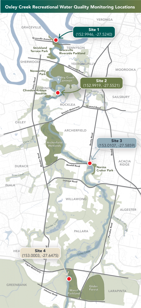
Monthly creek water sampling is undertaken at four locations along Oxley Creek:
- Site 1 – Graceville Riverside Parklands, Graceville
- Site 2 – Cliveden Avenue Reserve, Cliveden Avenue, Corinda (To note: creek water sampling and analysis at Cliveden Avenue Reserve is undertaken by Brisbane City Council as part of their monthly Recreational Waters Monitoring Program).
- Site 3 – Beatty Road Bridge, Beatty Road, Acacia Ridge
- Site 4 – Warril Parklands, Paradise Road, Larapinta.
Further information on water quality can be found on Brisbane City Council’s water quality web site.
General information on safe use of waterways can be found on the Healthy Waterways website.
Water Quality Monitoring Results – Past Years
View the archived water quality results of past years below.
Water Quality Monitoring Results – 2024 Calendar Year
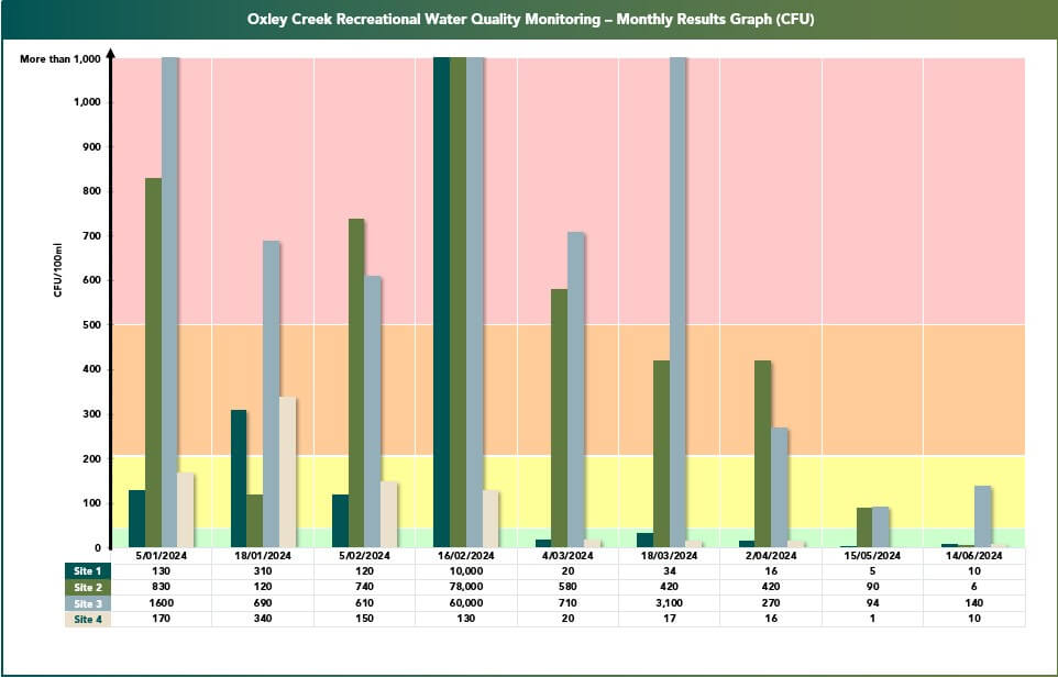
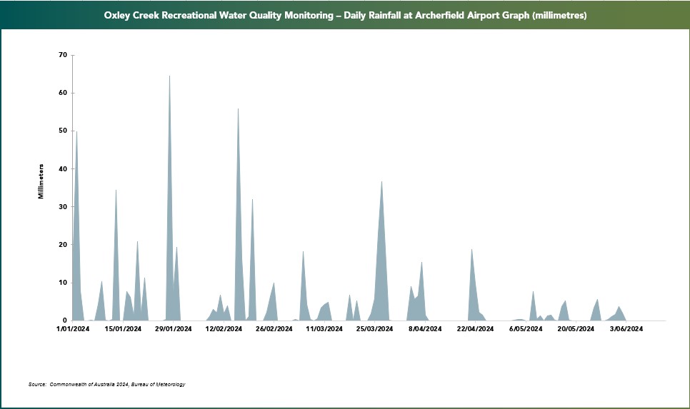
The first graph (below) shows the monthly water quality results for the 2024 calendar year, while the second graph (below) shows the daily rainfall totals for the 2024 calendar year, as measured at Archerfield Airport (source: Bureau of Meteorology, 2024).
A direct visual comparison of the two graphs shows a high level of microbial contamination often correlates with heavy and/or sustained rainfall.