Warril Parkland
Discover one of the Oxley Creek Corridor’s southern-most reserves
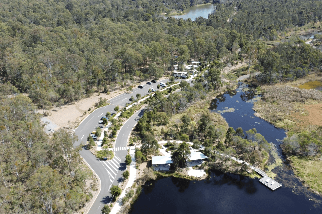
Warril Parkland, located on Paradise Road at Larapinta, contains 84 hectares of bushland. This bushland is part of the largest remaining continuous stretch of open eucalypt forest in South East Queensland, known as the Flinders-Karawatha Forest Corridor.
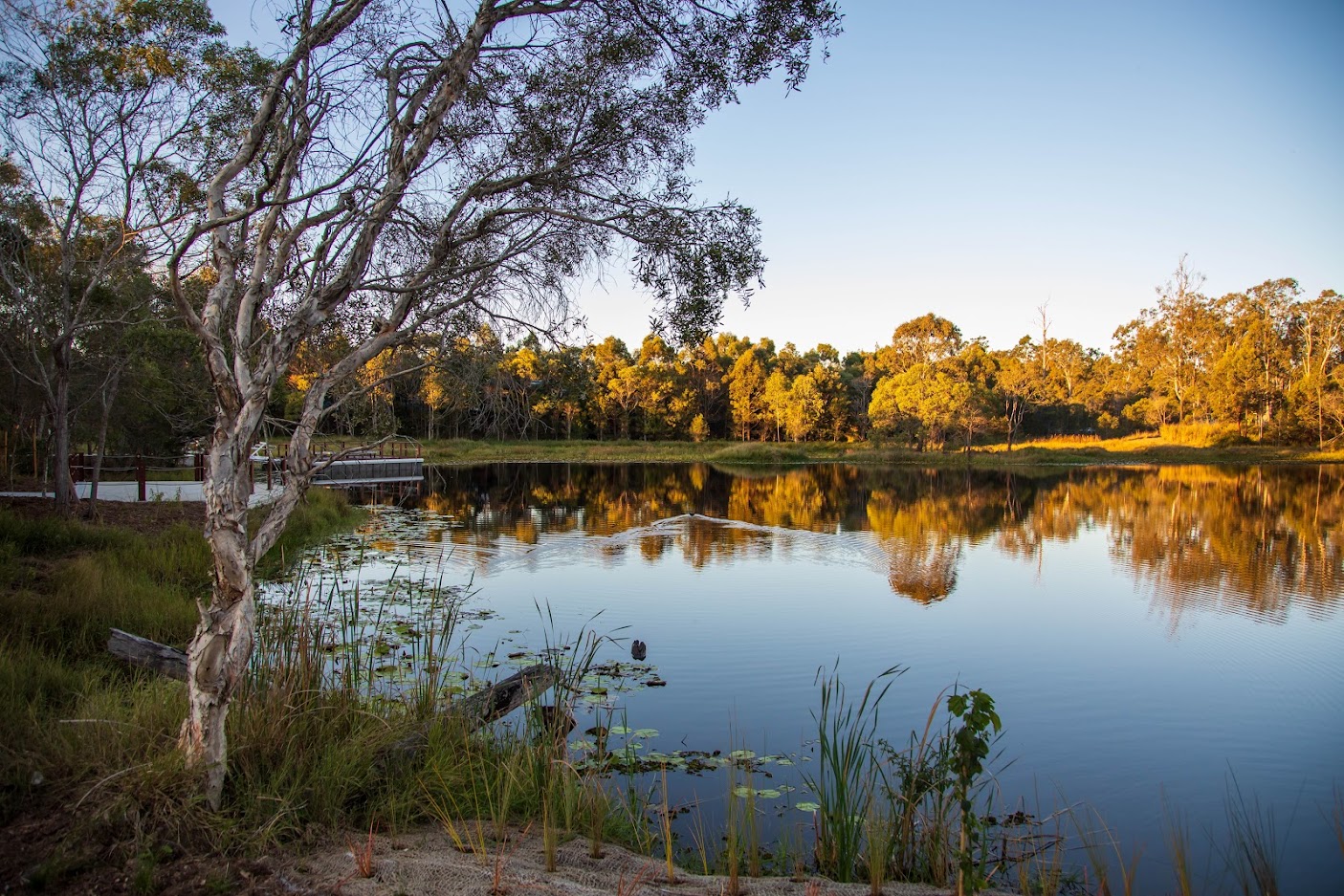
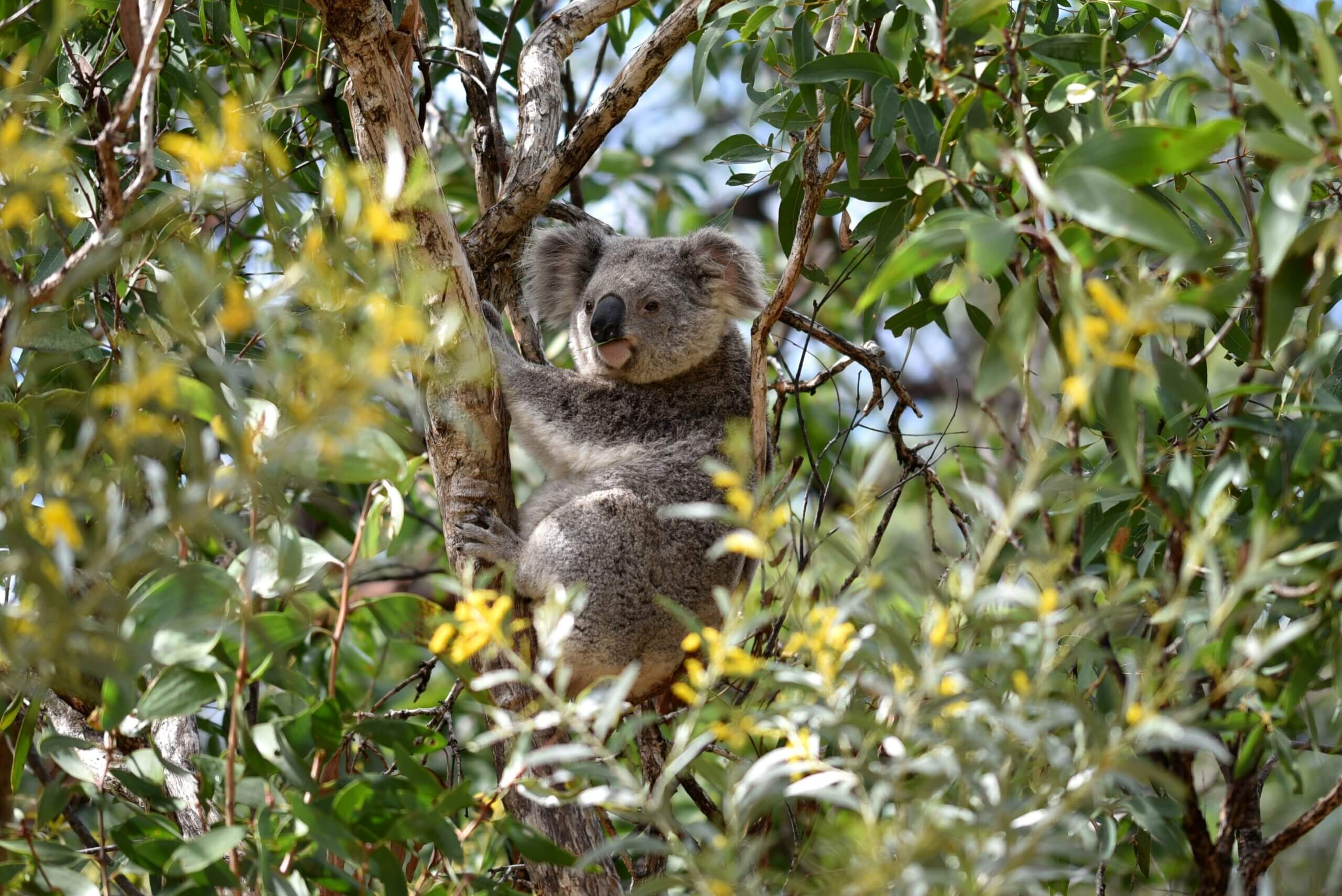
This ecologically significant area is home to threatened ecosystems and diverse wildlife, including gliders, koalas and more than 100 species of birds. With its rich natural environment of forests and lakes, Warril Parkland offers a unique opportunity to connect with nature and explore one of Brisbane’s most valuable green spaces.
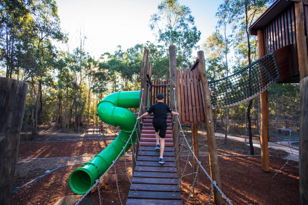
Stage one of Warril Parkland (nature-based adventure parkland) in Larapinta is open.
Features include:
- nature-play playground incorporating water play
- shaded picnic areas, barbeques and seating
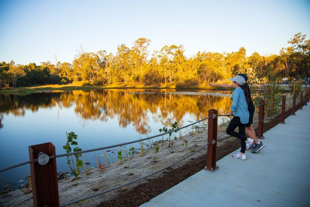
- lake edge boardwalk and pontoon
- birdwatching opportunities
- Warril Parkland Discovery Trail and the [Junior Ranger Program]
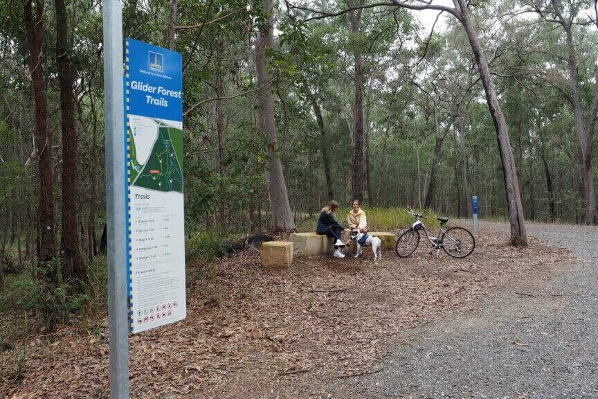
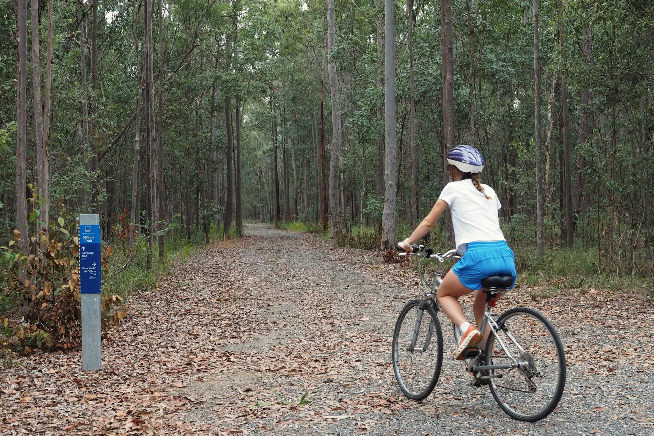
- three gravel walking & off-road cycling trails
Background
The creation of a new public park at Warril Parkland, formally known as Sergeant Dan Stiller Memorial Reserve (south-east section), was first proposed in Brisbane City Council’s Oxley Creek to Karawatha Outdoor Recreation Concept Plan (Recreation Plan).
The ideas suggested in the Recreation Plan were further developed into a priority project for the Oxley Creek Transformation Master Plan in 2018. The priority project was known as the Nature-based Adventure Parkland project.
Glider Forest
Glider Forest Reserve is located on the eastern side of Paradise Road, opposite Warril Parkland. Nestled within the Glider Forest Reserve, existing fire management trails have been upgraded in accordance wiht the Recreation Plan with signage and rest points to revitalise 6 kilometres of scenic gravel trails perfect for walking, off-road cycling, and bird watching.
Community vision and engagement
Both the Oxley Creek to Karawatha Outdoor Recreation Concept Plan and the Oxley Creek Transformation Master Plan 2018 included community consultation programs, which resulted in public support for the Warril Parkland project and the proposed recreational outcomes within both Glider Forest and Warril Parkland.
Off-road cycling strategy
To meet the growing demand for off-road cycling, Brisbane City Council developed the Brisbane Off-Road Cycling Strategy 2021 to guide the planning and delivery of facilities that balance user needs with environmental protection.
Extensive community engagement began in 2019, with more than 1400 initial survey responses helping shape a draft strategy. A second consultation phase in late 2020 attracted over 3200 survey responses and 241 formal submissions, with strong support for more authorised off-road cycling options.
Based on this feedback, the final strategy was released in December 2021. It outlines Council’s approach to providing sustainable off-road cycling opportunities across the city, including short-term plans to open access to shared-use trails and fire tracks in natural areas like Glider Forest.
Future stages
With the first stage of Warril Parkland now complete and Glider, there are future opportunities to expand the parkland to include the three lakes that form part of Oxley Creek, located approximately 400m northwest of the playground picnic area.
Potential future outcomes for Warril Parkland include:
- a visitor and/or community centre
- an event and activity lawn
- non-motorised watercraft launching facilities
- canoe and kayak paddling area
- bird watching facilities
- bushwalking, cycling and horse-riding trails
- bike, canoe and kayak hire facilities
- complementary nature-based eco-tourism activities
Project timeline
2018
- A nature-based Adventure Parkland in Larapinta is identified in Oxley Creek Transformation Master Plan
2020
- Stage 1 of the Nature-based Adventure Parkland completed
2021
- Brisbane Off-Road Cycling Strategy identifies Glider Forest
2023
- Glider Forest Shared Trails completed
Resources
Explore our other programs
Oxley Creek Transformation
Pine Mountain Quarry
Mt Coot-tha Precinct
Sustainable Action Training
Biodiverse Brisbane Initiative
Flood Resilient Suburbs Programs

Sustainable Business Hub